
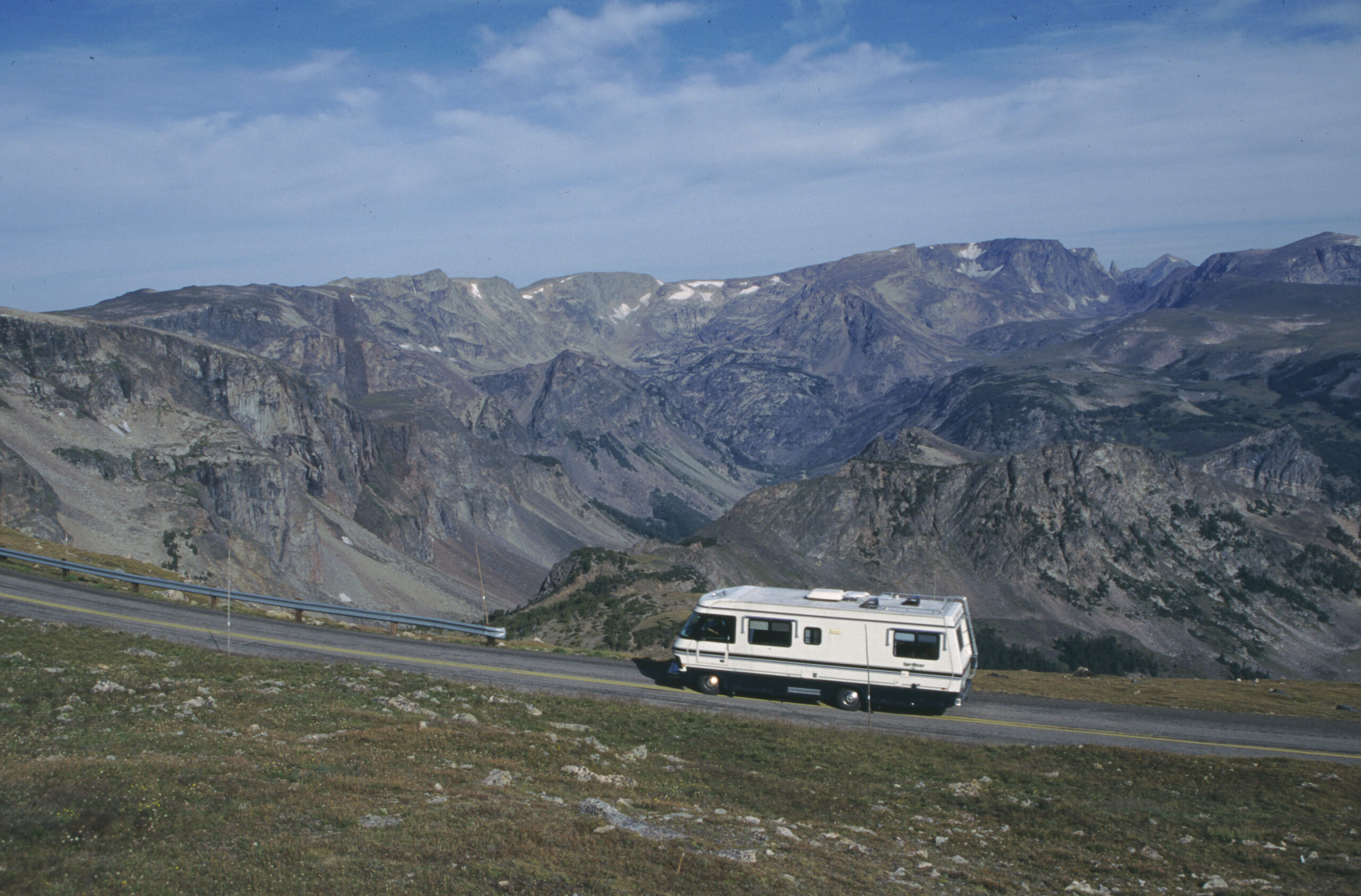
From Red Lodge to Cooke City, the roughly 68-mile stretch of U.S. Highway 212 climbs from 5,200 feet to 10,947 feet in just 12 miles. This is Beartooth Highway, rising along the Montana-Wyoming border. The road has no official vehicle-length restriction. Even so, signs on the Cooke City approach advise vehicles over 40 feet not to cross the summit. It is not a legal prohibition, but the road offers its own warning.
Five Layers of Switchbacks
Beginning with the first switchback section out of Rock Creek Canyon, two more switchbacks follow even after the road passes the Montana-Wyoming border at 10,275 feet. Another sharp zigzag awaits on the westbound descent beyond Beartooth Pass, at 10,947 feet. The road is managed by the National Park Service, though it is not within a national park, while the Montana Department of Transportation oversees both Montana ends of the route—an unusual management arrangement. The Wyoming Department of Transportation has stepped away from maintaining this portion because it does not meet that state’s highway standards. The route also crosses three national forests—Custer, Shoshone, and Gallatin—adding overlapping jurisdictions to its unusual character.
In 2026, Opening Was Scheduled a Week Early
Beartooth Highway closes each year because of snow and generally does not reopen until late spring. Snow removal takes place only once each spring, usually in May, though heavy-snow years can push it into June. In 2026, the road was scheduled to open Friday, May 22, a week earlier than originally planned, subject to weather conditions. Even after opening, snow squalls, strong winds, and thunderstorms are common near the summit in midsummer. When the highway opens, the seasonal Beartooth Basin Ski Area near Beartooth Pass at the state line also opens briefly; its season generally ends in July. The highway itself typically closes again around Columbus Day in mid-October, though weather can bring an early closure as soon as September.
What RV Travelers Need to Know
Road guidance recommends allowing at least two hours for the 68-mile trip from Red Lodge to Cooke City. On sections with repeated sharp curves, brakes can overheat easily, making low gears and engine braking essential. Because elevations exceed 10,000 feet, altitude sickness is also a concern; travelers who are sensitive to high elevations should plan frequent breaks. There are no fuel stations or service facilities near the summit, so fuel and drinking water should be stocked up in Red Lodge or Cooke City. Road conditions can be checked through Montana travel information and the Wyoming Travel Information Service, and travelers are also advised to call the Red Lodge Area Chamber of Commerce or the Beartooth management area to reconfirm closures before departing.
Lessons From the 2005 Landslides
The road has not always had an easy passage. On May 19 and 20, 2005, major landslides and rockfalls destroyed several sections of road between mile markers 39 and 51 on the Montana side. The repairs cost $20.4 million and were originally targeted for completion that October. Although construction finished ahead of schedule, it took a full year before the road reopened. Near the summit of the switchbacks, crews removed about 100,000 cubic yards of rock from a 0.5-mile section, excavated down to solid bedrock, and built new supports. Careful observers can still see signs of that event on the slopes beside the road.
What the 40-Foot Advisory Means
No legal restriction does not mean every size of vehicle is safe here. The road repeatedly narrows into tight-radius switchbacks with little or no shoulder, leaving large motorhomes and combinations towing long trailers vulnerable to crossing the centerline or encountering trouble when meeting oncoming traffic. The 40-foot figure is based on experience, not law. Even RVs shorter than that should proceed slowly through the switchbacks and use pullouts to let following vehicles pass.
Another Gateway to Yellowstone
Beyond Cooke City, Beartooth Highway continues to Yellowstone National Park’s Northeast Entrance. Passing the Absaroka-Beartooth Wilderness, the route offers alpine lakes in many places and, with its brief opening season, remains a route worth considering for summer travelers entering Yellowstone from the northeast.
Photo: Photo by Fred Pflughoft, provided by Wyoming Travel & Tourism / Public Domain, Federal Highway Administration America’s Byways (fhwaapps.fhwa.dot.gov/bywaysp/photos/64234)