
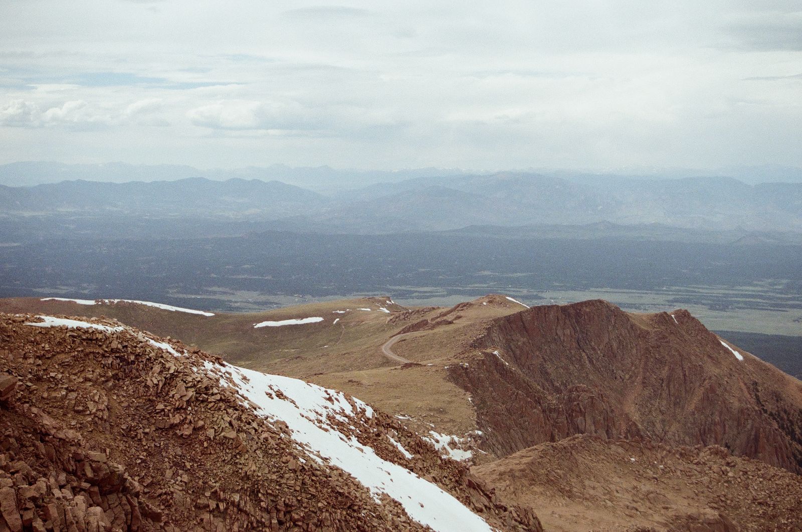
Trail Ridge Road crosses Rocky Mountain National Park and rises to 12,183 feet along its 48-mile route. Eleven miles of the drive pass through alpine tundra, where trees no longer grow. That is why it carries the distinction of being the highest continuous paved road in the continental United States. Connecting the park’s gateway towns of Estes Park and Grand Lake, the road opens only for the summer season.
Eleven Miles Without Guardrails
Once the road passes above tree line, guardrails disappear on both sides. Steep drop-offs remain exposed, and curves are frequent. On windy days, vehicles towing trailers can be pushed by crosswinds, making it important to slow down more than usual. Fog and hail can also move in quickly at this elevation, so it is safer to set out prepared for abrupt weather changes.
No RV Length Limit on the Road, but Campgrounds Have Them
According to park rangers, Trail Ridge Road itself has no separate restrictions on RV length or trailer towing. Old Fall River Road, which branches off within the same park, is different. This one-way unpaved mountain road prohibits vehicles longer than 25 feet and any vehicles towing trailers. Travelers must use Trail Ridge Road instead. Before departing, call 970-586-1222 for an automated recording with the latest road conditions.
The Alpine Visitor Center Is the Only Stop for Food or Services
The Alpine Visitor Center near the summit is the only facility along the 48-mile route. It has restrooms, a small restaurant, and a gift shop. There are no gas stations. Filling up completely in Estes Park or Grand Lake before setting out is essential for crossing without fuel concerns. That calculation is especially important for lower-mileage vehicles such as RVs.
Moraine Park Has 49 Hookup Sites on the East Side; Timber Creek Has None on the West
On the park’s east side, Moraine Park Campground has 244 sites, including 88 RV sites; 49 of those have electric service. Standard sites without electricity cost $35 per night, while electric sites cost $55. On the west side, Timber Creek Campground has 98 sites, none with hookups, and does not accept rigs whose combined vehicle-and-trailer length exceeds 30 feet. Anyone planning to cross Trail Ridge Road to the west side should calculate Timber Creek’s length limit in advance.
Rock Cut and the Tundra Communities Trail
Near the summit, beside the Rock Cut overlook, the Tundra Communities Trail offers a short walk. The boardwalk can be completed in about 30 minutes round trip, but breathing is much more difficult at this elevation than on level ground. Elk and bighorn sheep are not uncommon in the meadows beside the road. Unless there is enough room to pull over completely, it is safer for both wildlife and following traffic to continue slowly.
How High Elevation Affects the Body
Above 12,000 feet, dizziness and headaches can be more common than usual. Those arriving directly from near sea level should drink water more often and walk at a slower pace. Travelers bringing pets should keep stops short so paws are not burned on hot pavement, and remember that dogs can also show symptoms of altitude sickness.
Stage 2 Fire Restrictions Are in Effect
At the time of publication, Stage 2 fire restrictions were in effect throughout the park because of Colorado’s extreme wildfire risk and weather outlook. Campfires were permitted only in designated fire rings, while smoking was restricted to vehicles, paved areas, and designated locations. It is safest to check current alerts again before entering the park.
Entrance Fees and Timed Entry
Standard entrance fees are $30 per passenger vehicle, rising to $35 during peak season. Motorcycles cost $25 to $30, while visitors entering on foot or by bicycle pay $15 to $20 per person. Some areas, including Bear Lake Road, require timed-entry reservations during peak season. Trail Ridge Road operates separately from that reservation system, but travelers planning to visit the Bear Lake area the same day need to reserve a time slot separately.
When the Road Can Be Crossed
Trail Ridge Road typically opens in late May and operates through mid-October. Opening and closing dates change each year according to snow conditions. An early-morning crossing generally means lighter winds and better odds of seeing wildlife. Because afternoon thunderstorms are common, it is better to plan to clear the summit section before noon.
Estes Park Has More Services
Estes Park, the eastern gateway, is the larger town, with gas stations, grocery stores, and repair shops. Grand Lake on the west side is much smaller, and travelers arriving late in the evening may have trouble finding businesses that are open. Those traveling east from the west side should stock up on fuel and supplies in Grand Lake beforehand.
The Other Three Campgrounds Have No Hookups
In addition to Moraine Park and Timber Creek, the park has three more campgrounds. Aspenglen has 52 sites, Glacier Basin has 150, and Longs Peak has 26; all offer only standard sites without electricity. Longs Peak is primarily made up of walk-in sites for climbers, making it difficult for large RVs to use. These three can still be options for tent campers or travelers with small trailers who do not need hookups.
The West Side Is Moose Country
Kawuneeche Valley, where Timber Creek Campground is located, is an area with especially frequent moose sightings. Moose are often seen grazing in wetlands beside the road early in the morning and around sunset. They can be even less predictable than bears, however, so visitors should not get out of their vehicles to approach them.
Do Not Rely on Cell Service
Many interior sections of the park have no signal regardless of carrier. Before climbing Trail Ridge Road, download offline maps and save the locations of the Alpine Visitor Center and campgrounds. The Kawuneeche Visitor Center on the west side also provides road-condition updates and wildlife-sighting information, making it worth a stop for visitors entering from Grand Lake.
Data Source: NPS API (developer.nps.gov) / Recreation.gov RIDB
Photo: Graham Gordon / Pexels