
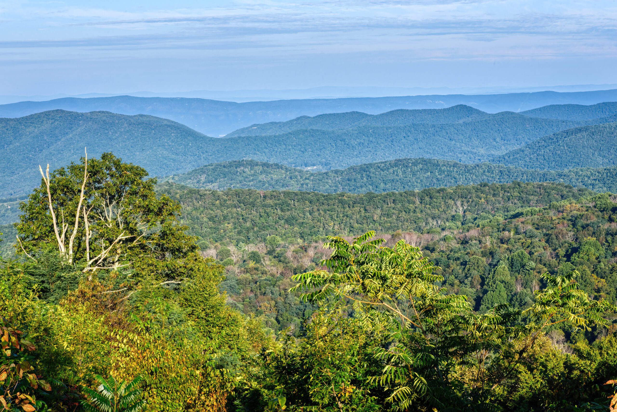
There are 75 overlooks along this 105-mile road—an average of one place to pull over every 1.5 miles. Skyline Drive, which runs north to south through Shenandoah National Park, was completed in 1939 along the crest of the Blue Ridge Mountains. The speed limit is 35 mph, and the drive can be completed in three hours without stops, but stopping at overlooks can easily fill an entire day. For a road that follows a single ridge, it is a substantial route, so plans to cover it as a one-day drive may be worth reconsidering.
A road open to RVs, with one exception
Skyline Drive is open to RVs, travel trailers, and even horse trailers. Fall foliage season is especially busy, but spring wildflowers and early-summer greenery offer scenery of their own. The sole exception in the park is Marys Rock Tunnel at milepost 32.2. The 670-foot tunnel has a clearance of 12 feet, 8 inches—the only RV travel restriction in Shenandoah officially identified by the park. Before entering the tunnel, turn on your headlights and check your vehicle height once more.
Four gateways, three districts
Skyline Drive has four ranger-staffed entrance stations. It begins at Front Royal at the north end (milepost 0.6), passes Thornton Gap (milepost 31.5) and Swift Run Gap (milepost 65.7), and ends at Rockfish Gap (milepost 105.4). These four entrances also mark the boundaries of the park’s North, Central, and South districts. Whether making a brief pass through or allowing three days to explore each district, these gateways provide useful planning points.
A ridge road completed in 1939
Skyline Drive was completed in 1939. Because it follows the crest of the Blue Ridge Mountains, Shenandoah Valley and the Piedmont lowlands appear in alternating views on either side of the road. At Rockfish Gap on the southern end, the road connects directly with the Blue Ridge Parkway. Linking the two roads makes for a much longer ridge-top journey.
A different character in each district
The North District is closer to the Front Royal entrance and is relatively busy. The Central District has a concentration of trailheads around Big Meadows Visitor Center, along with stone buildings constructed by the Civilian Conservation Corps in the 1930s. The South District is generally the quietest of the three, making Loft Mountain Campground a good base for a relaxed stay of several days.
Four campgrounds, no hookups
There are four campgrounds in the park. Big Meadows is the largest, with 221 sites, followed by Loft Mountain with 207 and Mathews Arm with 165. Lewis Mountain has 30 sites. Each operates differently. All sites at Big Meadows are reservation-only, so it can be difficult to secure a spot upon arrival. Loft Mountain and Mathews Arm offer both reservations and first-come, first-served sites, though reservations are strongly encouraged. Lewis Mountain alone operates on a first-come, first-served self-registration basis without reservations, making it a useful place to check for travelers planning later. None of the four campgrounds has electric hookups—not a single site. Throughout the park, campers must rely on batteries and generators.
Ridge-top weather can change quickly
Because the road runs along a ridge near 3,000 feet in elevation, the valleys may be clear while fog frequently settles over the road. The 35 mph speed limit reflects both the winding terrain and these changing conditions. Deer commonly dart into the roadway, so slowing down is especially prudent around dawn and dusk. In winter, snow and ice often lead to section closures, so check Skyline Drive conditions before departing.
Fees are card-only
Beginning July 1, 2025, Shenandoah no longer accepts cash at entrance-fee stations. Only credit cards, debit cards, and mobile payments are accepted. Because card terminals can fail in the mountains, it is wise to have at least two payment methods ready in advance.
How to choose overlooks
It is not possible to visit all 75 overlooks in one day. The North District, close to the Front Royal entrance, works well for a day trip. The Central District has many hiking trails around Big Meadows Visitor Center and is worth setting aside a day to explore on foot. The South District is quieter and well suited to a multi-day stay based at Loft Mountain Campground. During fall foliage season, traffic can back up along the entire route, so choosing several preferred overlooks beforehand and visiting them in order can save time.
Parking and trailheads
The park has been carrying out parking-lot improvement work at the Old Rag trailhead since May 2026, with completion targeted for November. Until the work is finished, parking may be more limited than usual. The park has also advised that vehicles parked outside designated areas on access roads near the park boundary may be towed. Skyline Drive status is also available by text: send SHENALERTS to 888777 for safety alerts such as closures and reopenings.
More than 30 crossings with the Appalachian Trail
Appalachian Trail markers appear often beside Skyline Drive. The long-distance trail, which runs from Georgia to Maine, crosses Skyline Drive more than 30 times in the Shenandoah section. That means trailheads are scattered along the road for walks as short as 30 minutes or as long as a half-day after parking the RV. Establishing a base camp at a campground and choosing a different trailhead for a short hike each day is one way to experience the route.
How to park a large vehicle at overlooks
The 75 overlooks vary widely in size. Some are narrow and only hold a few passenger vehicles, while others are large enough for RVs and trailers to turn around comfortably. The larger the vehicle, the more helpful it is to study the map ahead of time and plan around larger overlooks rather than pulling into each one without knowing its layout. When entering an overlook, keep a safe distance from the vehicle ahead and move slowly. After stopping, park close to the shoulder so vehicles behind can pass.
At 105 miles, Skyline Drive may look short on paper, but add 75 overlooks, one tunnel, and four campgrounds without hookups, and it becomes a trip of several days rather than a one-day drive. With the Blue Ridge Parkway continuing south, the ridge-top route extends much farther; travelers with extra time may want to combine both roads into one journey.
Fuel and supplies: stock up ahead of time
Gas stations and grocery stores are not closely spaced along the road. It is safer to fill up on fuel and groceries in communities near entrances, such as Front Royal or Swift Run Gap, before entering. Unlike the villages in western national parks such as Grant Grove or Lodgepole, Skyline Drive does not have a large market within the park. Travelers planning to move between campgrounds over several days are better off shopping generously near the entrance before heading in.
Photo: The Point Overlook, Lara Ellis / National Park Service (nps.gov). Data Source: NPS API (developer.nps.gov)