
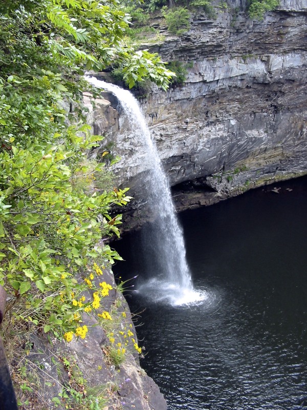
DeSoto State Park’s October 28 fall-color update describes a brightening Lookout Mountain landscape, rating the change as high, or 50–75%. Some early-changing trees have reached or approached their strongest color, while later-turning oaks remain mostly green. The report offers a reason to explore the park’s woods at the end of October, but it does not establish a single peak date for every trail or guarantee the same display on arrival.
Color Builds at Different Speeds
The park highlights reds and yellows among chalk maples, dogwoods, sourwoods, hickories and sweetgums, alongside other changing plants. Goldenrods and asters are also flowering. These observations come from the dated park update rather than an independent visit by K-RVing; the page does not give a separate observation date. The mix matters for a walking itinerary: one stand of trees can look markedly different from another without the broader report being inconsistent.
DeSoto’s official hiking guide describes more than 35 miles of trails, with routes ranging from easy to strenuous. For a shorter outing, the Talmadge Butler Boardwalk reaches a 20-foot deck above the pool at Azalea Cascade. The H. Stanley Sims Native Plant Area, near the lodge on Blalock Drive, offers an easy 1,000-foot loop. Those are alternatives to committing to a longer ridge or river hike simply to find changing leaves. Check the park’s trail maps for the route that fits the group; trails close at dusk.
Choose the Campsite and Approach Before Driving
The Improved Campground lists 94 full-hookup sites with water, sewer and 30/50-amp electric service. Back-in and pull-through layouts are available, and the listed average pad size is 16 by 60 feet. Confirm the specific site’s fit when reserving rather than treating an average as a guarantee. Two comfort stations provide showers and laundry, but campground Wi-Fi does not reach every site and cell reception can be patchy. The park takes site-specific reservations through its official booking service or by phone at 256-845-5075; current availability must be checked separately.
The park advises RVs and other large vehicles arriving from I-59 to use Exit 218 or 222 and Alabama Highway 35. Its written directions specifically warn against Tutweiler Gap, Wades Gap and Beasons Gap. Trailers and RVs should also avoid County Road 613, the road to DeSoto Falls. A navigation app’s suggested shortcut is therefore not enough to plan the approach. Save the official written directions before leaving reliable service, and choose the campground route independently of a waterfall sightseeing stop.
DeSoto Falls occupies a separate park area seven miles from the main park, with a $5-per-vehicle parking fee; the main area has no entrance fee. For an overnight visit, the campground lists a two-night weekend minimum, 2 p.m. check-in and 11 a.m. checkout, with rates varying by season and holidays. Reserve the stay before traveling and confirm late-arrival arrangements if needed. Separating the campsite, suitable driving route and daylight walk keeps the foliage outing practical without assuming that a favorable color report also means an available campsite.
Sources: DeSoto State Park’s October 28 fall-color update · Official hiking guide · Improved Campground · Official directions and trip planning · Official reservations.
Photo: Jsfouche, September 5, 2004. Original photograph, licensed under Creative Commons Attribution-ShareAlike 3.0. Original image used without cropping or other edits.
