
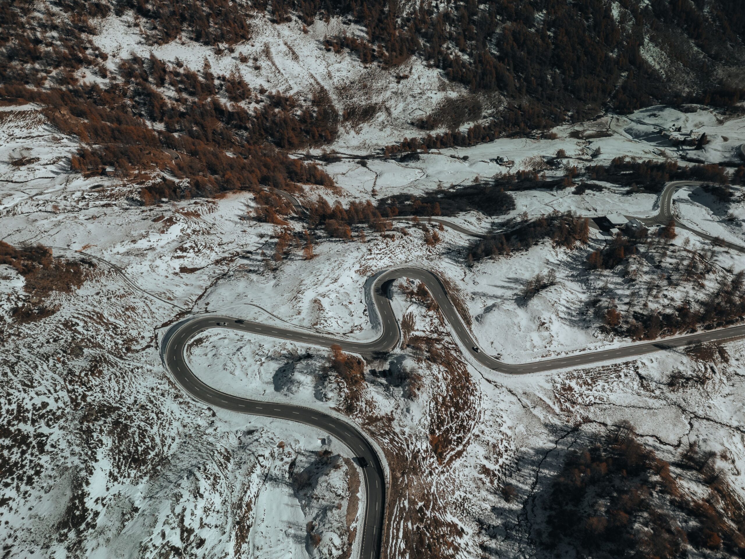
The Beartooth Highway (US 212) runs 68.7 miles from Red Lodge, Montana, to Cooke City, the northeast gateway to Yellowstone. Built as a Works Progress Administration (WPA) project in the 1930s, this mountain road crosses Beartooth Pass at 10,947 feet along the Montana-Wyoming border and is regarded as one of the West’s premier RV drives, comparable to Going-to-the-Sun Road in Glacier National Park.
From 5,500 Feet to 10,947 Feet
Red Lodge, the starting point, sits at roughly 5,500 feet. The route initially rises through a gentle valley before reaching a series of switchbacks with sharp turns that generally require speeds of 25 to 30 mph. While climbing the switchbacks, it is safer to switch off the air conditioner and keep an eye on coolant and transmission temperature gauges. Near the summit, atmospheric pressure drops to about 70% of sea-level pressure, and temperatures can be about 20°F cooler than in the Yellowstone River valley even in summer. Mid-summer daytime highs often do not exceed 70°F, and snow can remain beside the road into August. Travelers not acclimated to the elevation should pace themselves when planning strenuous hikes, as altitude sickness can occur.
Lakes and Wildlife Among the Peaks
After crossing into Wyoming, Gardner Lake and Mirror Lake appear in succession. At Mirror Lake, an overlook looks down into the gorge just beyond the guardrail, making it a worthwhile place to pull over and walk around. Before the pass, a granite spire known as Bear’s Tooth is visible from the road. It is one of the sharp peaks carved by repeated glaciation and the namesake of the surrounding area. Near the summit, travelers may often spot plump high-elevation rodents such as marmots, while clear skies can quickly give way to summer showers mixed with hail. Snowfields throughout the area feed countless small streams, leaving the plateau so wet that running water can be heard at many pullouts. Cooke City and the northeastern Yellowstone area are also grizzly bear habitat, so it is important to follow basic practices at campgrounds and overlooks: store food in a vehicle or bear-resistant container and keep campsites clean.
Is Vehicle Length Really a Problem?
The Beartooth Highway itself has no legal vehicle-length limit. However, signs on the Cooke City approach advise against taking vehicles longer than 40 feet over the Beartooth Pass section. Large motorhomes with less powerful gas engines, such as Class A models, may be challenged by the switchbacks. Those towing a fifth wheel or large travel trailer should plan ahead for the wide swing needed on the tight curves near the summit. Some RV travelers who have driven the route report leaving a larger trailer nearby and crossing the pass with only their pickup truck. The road is generally open only from late May through mid-October, and its high elevation means sudden hail showers can develop even in mid-summer.
Where to Camp
Across the state line in Wyoming, management shifts from Custer National Forest to Shoshone National Forest, where several well-maintained campgrounds are located along the route. Island Lake, Beartooth Lake, Crazy Creek, and Fox Creek campgrounds are spread between 9,000 and 6,000 feet. Of these, Fox Creek Campground has electric hookups, making it particularly useful for travelers without dry-camping equipment. Most of the others are National Forest-style sites without hookups, so travelers should carry ample water and food. For those who prefer dispersed camping in National Forest land, Forest Service Road 2124, just before the state line on the Montana side, is known as a designated area. It has no facilities, including water or sewer service, so it is best attempted only with fully self-contained equipment. Check Recreation.gov again before departure for current reservation availability and fees.
What to Stock Up On Before Leaving
Red Lodge has a water fill station and dump station beside the Chamber of Commerce, as well as an IGA grocery store and several stations for gasoline, diesel, and propane. The challenge comes after that. For about 175 miles, until the route meets I-90 again in Livingston, there are few meaningful services. Fully stock up on fuel, propane, drinking water, and groceries in Red Lodge to avoid getting stranded along the way. Cooke City has small gas stations as well as lodging and restaurants, but its selection is more limited than Red Lodge’s, so it is better to complete major grocery shopping before leaving Red Lodge. On the return from Cooke City, travelers also often mention the Chief Joseph Scenic Byway as an alternate route. It offers a different canyon landscape and completes a loop toward Cody.
From the summit, views open eastward to the Bighorn Mountains more than 80 miles away, while a lake-dotted plateau stretches south. Limited services are part of what keeps the Beartooth Highway less crowded. For RV travelers prepared for its four key variables—sharp curves, elevation, changing weather, and wildlife—it is one of the West’s most remarkable scenic drives.
Photo: Pexels / urtimud.89, Aerial View of Winding Mountain Road in Snow (https://www.pexels.com/photo/aerial-view-of-winding-mountain-road-in-snow-35116924/)