
444 miles. That is the full length of the Natchez Trace Parkway. Running north to south through Mississippi, Alabama, and Tennessee, the road has no traffic lights, billboards, or franchise signs. Most importantly, there are no gas stations or restaurants on the parkway itself. For anyone planning to drive it by RV, that one fact changes the rhythm of the trip entirely.
The Old Road: What You’re Following
The Natchez Trace was originally a route used by Native Americans, then later a return path for boatmen who sold their boats after carrying goods downriver and walked home. The National Park Service developed today’s scenic roadway along this historic corridor. The parkway begins near Natchez in the south and ends near Nashville in the north, with its full length managed as a national park unit. Low speed limits and gentle curves make it manageable for larger RVs, but travelers should allow plenty of time to reach their destination.
The Parkway’s Only Three Campgrounds
There are only three official campgrounds on the parkway itself: Rocky Springs at milepost 54.8, Jeff Busby at milepost 193.1, and Meriwether Lewis at milepost 385.9. All three are free and available on a first-come, first-served basis, without reservations. None has electric hookups, showers, or a dump station, though each has restrooms. These campgrounds are especially busy in spring and fall, particularly on holiday weekends.
Meriwether Lewis Campground, the northernmost of the three, has 32 sites, potable drinking water, and flush toilets, making it the most convenient of the group. Each site has a grill and fire ring, and the campground is surrounded by forest. Rocky Springs and Jeff Busby have more basic amenities, but they are quieter and better suited to stargazing. At the end of the campground road at Jeff Busby, a 1.8-mile loop trail leads to the Little Mountain Overlook, rising to 584 feet—one of Mississippi’s highest points—with views on both sides. Near the overlook are four picnic tables without grills and a covered interpretive shelter, making it an easy side trip during an overnight stay.
The Meriwether Lewis name comes from the historic site beside the campground. Explorer Meriwether Lewis, who led the Lewis and Clark Expedition, died near this location at Grinder’s Stand in 1809. In 1848, with support from the Tennessee legislature, a broken-column monument was erected at his burial site. The broken column was a customary design of the time representing a life cut short. The monument and a pioneer cemetery remain within walking distance of the campground trail, offering overnight visitors another layer of the road’s long history.
What It Means to Have No Gas Stations or Restaurants
There are no commercial services anywhere on the parkway itself. To refuel or get a meal, travelers must leave at one of the exits and drive into a nearby small town. RV travelers should make a habit of identifying the next exit town before the fuel gauge falls below half. Larger RVs in particular tend to have lower fuel economy, and poor planning on this route can create real trouble. The same applies to water and groceries, which are safest to restock in towns off the parkway. Exit signs are spaced differently from one section to another, so marking fuel stops on a map in advance reduces the need for rushed decisions while driving.
A 50 mph Road Without Heavy Trucks
The speed limit is 50 mph along the full length of the parkway, dropping to 40 mph north of Leiper’s Fork, Tennessee, and near Ridgeland, Mississippi. The National Park Service prohibits commercial freight traffic on the road, so drivers do not have to share it with semitrailers, delivery trucks, or large buses. That is one reason the route is popular with bicycle travelers, and it also greatly reduces the pressure on RV drivers to change lanes among heavy commercial vehicles. Still, the lower speeds mean that completing the entire parkway takes more time than many travelers expect.
Near Tupelo, Mississippi, there is a visitor center that serves the entire parkway. It is open daily from 9 a.m. to 4:30 p.m. and provides information on the old route’s history as well as current road conditions, making it a useful first stop.
Mount Locust, in Front of Closed Doors
Mount Locust at milepost 15.5 is one of the oldest historic sites on the Natchez Trace. The visitor center and grounds are open Wednesday through Sunday, but the historic inn and store building itself is closed indefinitely because of structural concerns. Visitors cannot go inside, but the exterior remains visible, making this a worthwhile place to stop and walk around. Because the closure is related to safety, visitors should follow all posted instructions.
A View Defined by One Bridge: Birdsong Hollow
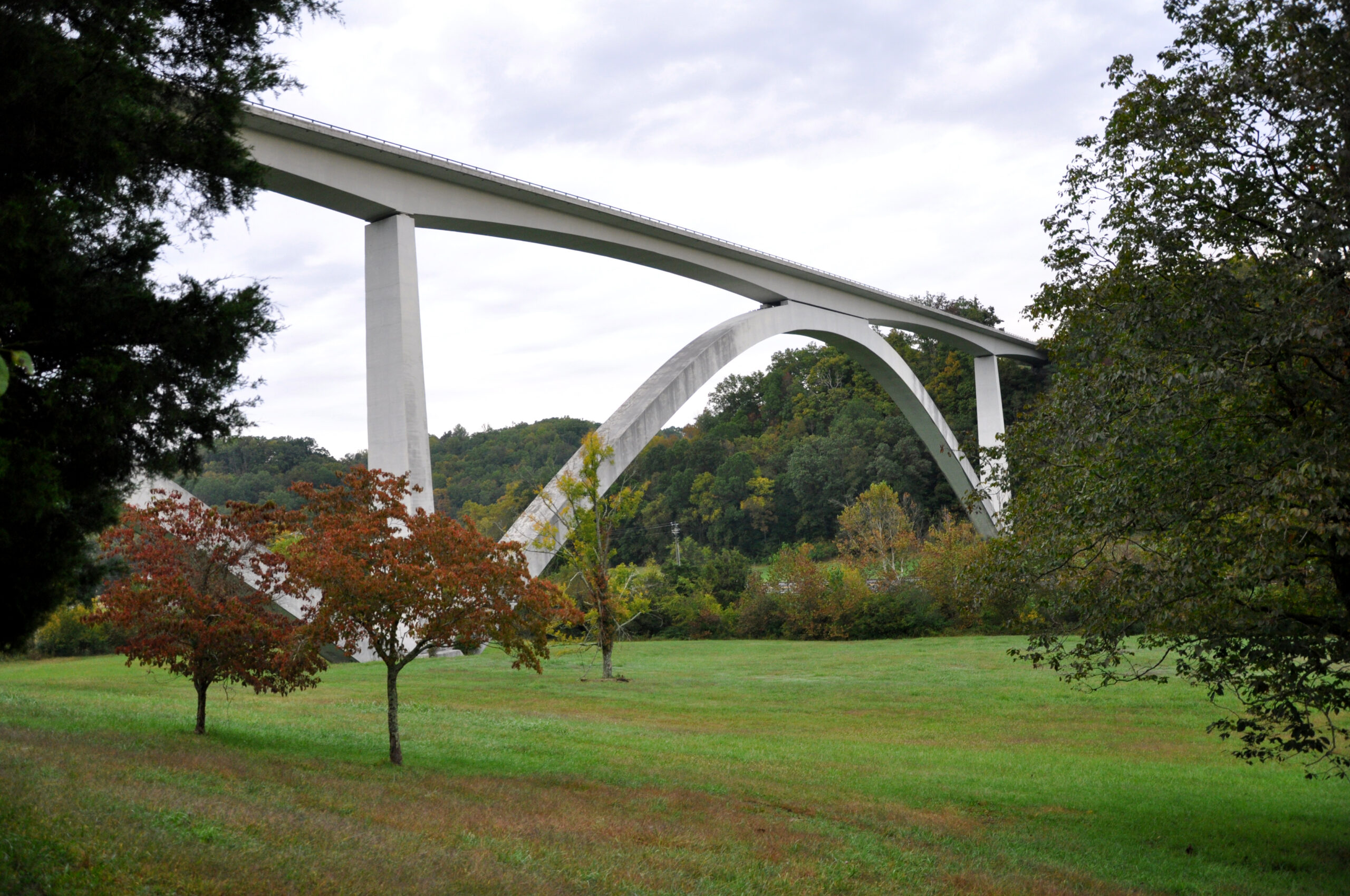
Near milepost 438, the Double Arch Bridge spanning Birdsong Hollow is one of the Natchez Trace’s signature sights. Its sweeping curves across the hollow capture the character of the route in a single image. Overlooks before and after the bridge allow even travelers in larger RVs to stop briefly and enjoy the view on foot. Those traveling the northern section may want to include it in their itinerary.
Check Current Closure Information, Too
Temporary closures may affect individual sections of the parkway because of weather, construction, or other emergencies. Before departure, travelers should not skip checking the official information page for current closures. Many stretches are forested, and cell service can be unreliable, so it is also wise to download the full route for offline maps in advance.
Rather than trying to cover all 444 miles in a single day, a slower itinerary of three or four days, linking the three campgrounds with several historic sites, better suits the character of this road. A highway without traffic lights, lanes without heavy trucks, and three campgrounds where travelers can spend the night for free: the Natchez Trace offers simple terms for RV travel, and that simplicity is precisely why it deserves to be driven slowly.
Data Source: NPS API (developer.nps.gov)
Photo: NPS Photo, Double Arch Bridge over Birdsong Hollow (milepost 438) — nps.gov/natr