
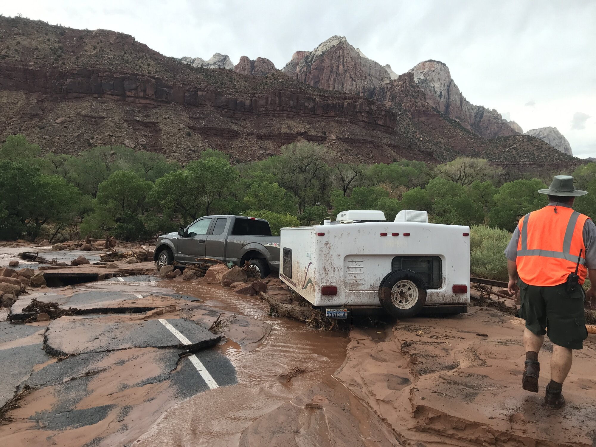
Tropical moisture flowing in from Eastern Pacific Hurricane Marie was expected to move into the inland Southwest that weekend, prompting the National Weather Service (NWS) office in Salt Lake City to issue a Sunday Flood Watch for much of southern Utah. The watch covered most of Washington, Iron, Kane, Garfield, and Beaver counties from 9 a.m. on September 6 through midnight. Marie itself was not expected to make landfall, but the NWS and private forecasters alike said its residual moisture, combining with the monsoon pattern, could produce localized heavy rain across Southern California, southern Nevada, Utah, and Arizona.
Areas Affected
The NWS expected rainfall rates of 0.4 to 0.6 inches per hour, with localized amounts of 0.6 to 0.8 inches per hour. The watch stated that excessive runoff could cause flooding in low-lying and flood-prone areas, including rivers, creeks, dry washes, slot canyons, slickrock areas, and recent burn scars. All of Iron and Beaver counties and most of Kane and Garfield counties were included in the expected heavy-rain area, and rain clouds were also forecast to pass through the Zion National Park area.
St. George was not included in the watch area. NWS precipitation maps did not show significant rain over the city, and the Sunday forecast called for a 60% chance of rain and a 20% chance of evening thunderstorms. Cedar City had a 30% to 50% chance of rain and thunderstorms through much of Sunday. That meant the higher elevations and sandstone canyon country around Bryce Canyon, Cedar Breaks, and Kane County faced greater risk than the lower elevations west of I-15.
The region had already experienced two significant rain events in August. On August 14, drainage channels overflowed and roads flooded in eastern Washington County from Hurricane, Utah, to Springdale. In late August, 11 hikers with hypothermia were rescued during flash flooding in Bryce Canyon National Park. A Flash Flood Warning was also issued for Garfield County on August 31, and the park advised visitors to avoid hiking. With the ground already wet and sediment deposited on canyon floors, more rain was expected to create additional hazards.
What RV Travelers Need to Know
The NWS repeatedly stresses one core rule: Because most flood deaths occur in vehicles, drivers should turn around when they encounter a flooded road. Heavy motorhomes and vehicles towing trailers are no exception. The depth of moving water and whether the roadway beneath it has washed away cannot be judged from the surface, and unpaved access roads crossing dry washes can turn into fast-moving water within minutes when rain falls upstream.
Slot canyon hikes and camping on wash bottoms should have been avoided during the daytime hours Sunday while the watch remained in effect. Steep switchbacks such as those on Bryce Canyon’s Navajo Loop and Queens Garden can turn muddy when wet, making travel up or down difficult. As the August incident showed, people stranded wet in a canyon can develop hypothermia even in summer. RVs parked near rivers or drainage channels were best moved to higher ground during the day.
A watch means conditions are favorable; once rain begins, it can be upgraded to a warning. Travelers should keep Wireless Emergency Alerts (WEA) enabled and check the NWS forecast one last time before entering canyon areas with weak service. Debris flows can also move down roads below recent burn scars, so checking Utah Department of Transportation (UDOT) road information alongside weather updates was advisable. The moisture was expected to continue beyond Utah into southern Nevada and Arizona, requiring the same caution that weekend for travelers headed toward Las Vegas or Tucson.
Photo: NPS / Original photo. Public domain. Photo date: June 29, 2021.