
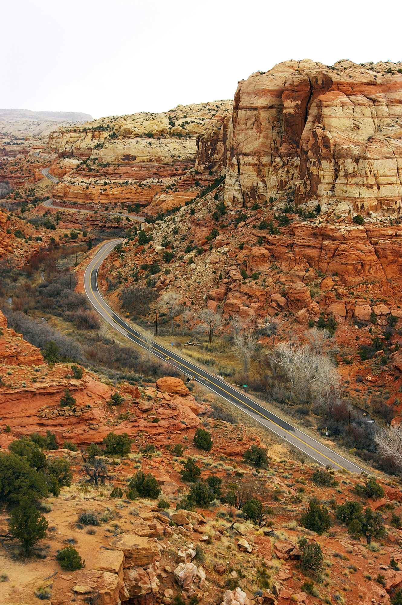
Utah State Route 12 in southern Utah was designated an All-American Road in 2002. Bryce Canyon National Park anchors its western end, while Capitol Reef National Park marks its eastern end; between them come Red Canyon, Grand Staircase–Escalante National Monument, and Boulder Mountain in Dixie National Forest. Its scenery makes it a dream route for many RV travelers, but the road asks something in return: the cliff-edged Hogback, Boulder Mountain Pass rising to 9,606 feet, grades reaching 8%, and long stretches without cell service. Fall is the prime season for this route, so the following roundup of campgrounds and road conditions is based on official data for travelers planning ahead.
Bryce Canyon: 51 RV Sites at North Campground
At Bryce Canyon, the starting point, there are two national park campgrounds. North Campground sits at about 8,000 feet across from the visitor center and is open year-round. A count of Recreation.gov listings shows 51 non-electric RV sites and 47 tent-only sites. Most RV sites accommodate rigs between 25 and 35 feet, while only a few accept vehicles longer than 40 feet. The fee is $30 per night, and the dump station operates seasonally. There are no electric hookups. Sunset Campground has 99 sites and is open from April through October at the same $30 nightly fee; it closes in winter. For both campgrounds, reservation details should be checked each season at go.nps.gov/BryceCamping.
Heading east from Bryce takes travelers through Tropic and Cannonville. Kodachrome Basin State Park is 7 miles south of Cannonville by paved road, while Escalante Petrified Forest State Park lies 1 mile west of the town of Escalante. These two state parks offer hookup-equipped alternatives for RV travelers who miss out on national park reservations.
Calf Creek: 13 First-Come, First-Served Sites at $15
Fifteen miles east of Escalante on State Route 12, immediately after crossing the Escalante River, is the BLM-operated Calf Creek Recreation Area. Its campground has only 13 sites, all first-come, first-served with no reservations, at $15 per night; holders of Senior or Access passes pay half price. Restrooms, picnic tables, and fire rings are provided, but little else. There is no trash collection, so visitors must pack out everything they bring in, and dumping RV gray water or sewage is prohibited. The BLM specifically states that large vehicles are not accommodated because of space limitations. Vans, short truck campers, and small trailers may be able to find a spot along the creek, but vehicles longer than 30 feet are better off passing it by.
The Lower Calf Creek Falls Trail begins at the campground and runs 6 miles round trip to a 126-foot waterfall. Sandy sections make it moderately difficult, and limited shade means hikers should bring ample water. On the trail, solid human waste must be packed out in a portable disposal bag. Bags are available for purchase at the Escalante Visitor Center.
The Hogback and Boulder Mountain: Two Stretches That Keep RVers Alert
Beyond Calf Creek, as the highway approaches the town of Boulder, State Route 12 climbs onto the Hogback. The road follows the spine of a narrow ridge, with cliffs dropping directly into tight canyons on either side. There is almost no shoulder, and curves are sharp. Drivers of large RVs or trucks towing a fifth wheel should slow substantially in high winds and use wider pullouts to let following traffic pass. Stopping in the travel lane for photographs should not be an option here.
Past Boulder, the road crosses Boulder Mountain in Dixie National Forest. At 9,606 feet, it reaches the highest point on the entire byway. The roughly 29-mile stretch from Boulder to Grover includes grades of up to 8%. On the climb, watch coolant temperature; on descents, use low gears and an exhaust brake. Drivers towing long trailers should reset brake-controller gain before entering the mountains. The highway remains open year-round, but it may close after major winter storms until plowing is completed, and early snow can arrive at elevations above 9,000 feet even in fall. Cell service is unavailable across much of this section, making it prudent to download offline maps in advance.
Capitol Reef’s Fruita: 71 Sites Beside the Orchards
At the byway’s eastern end, near Torrey, turn onto State Route 24 for Capitol Reef National Park. Fruita, the park’s only developed campground, has 71 sites, stays open year-round, and accepts reservations throughout the year. The fee is $25 per night, and water, restrooms, and a dump station are available; the dump station operates year-round. The NPS says there are no hookups, but a small number of sites in the Recreation.gov listings appear to be labeled as electric. Travelers who need that service should verify amenities for each specific site on the reservation page. Site-length allowances are most commonly between 28 and 34 feet, and roughly 20 sites can accommodate vehicles longer than 40 feet, making it the most comfortable campground on this route for larger RVs.
The park also has the primitive Cathedral and Cedar Mesa campgrounds. They have 6 and 5 sites, respectively, and are free. Each offers only picnic tables, fire grates, and pit toilets; no water is available. Cathedral is 36 miles from the visitor center, and its unpaved access road makes it better suited to high-clearance vehicles than RVs.
Planning an Itinerary
Two nights at Bryce North Campground, one night at Kodachrome Basin or Escalante Petrified Forest, one night at Calf Creek for smaller rigs, and two nights at Fruita allow travelers to cover this route without rushing. Fuel is available in Escalante, Boulder, and Torrey, but options in Boulder are limited, so it is wiser to fill the tank before leaving Escalante. In fall, the orchard beside Fruita Campground is in apple-harvest season, and campers can pick their own fruit and buy it by weight. After meeting all the challenges demanded by State Route 12, an apple eaten in the orchard’s shade is its reward.
Data Source: NPS API (developer.nps.gov) / Recreation.gov RIDB
Photo: Allysia Angus / Federal Highway Administration, National Archives / Original photo. Public domain. Photo date: March 19, 2006.
